骑行 · 2 小时 17 分钟 · 30 公里 · 65 个地点
维多利亚:加洛平古斯铁道绿廊
沿加洛平古斯铁道绿廊骑行30公里的自助导览:从 Johnson Street Bridge 出发,穿过老仓库区、农田和碎石乡道,一路骑进马西森湖畔的森林,这段海岸的整部历史按顺序摊开在你眼前,只因一条铁路破了产,把证据排成一条线留在了原地。旁白由 GPS 触发,边骑边听。
12.99 美元 一次性购买 免费应用 · 该导览在应用内解锁 购买前,应用商店会显示你当地的价格
起点
Johnson Street Bridge(内港)
加拿大不列颠哥伦比亚省维多利亚市,码头街与Pandora Avenue交叉口 · 从码头街与Pandora Avenue的交叉口出发。沿受保护的多功能通道穿过Johnson Street Bridge,然后右转进入通往Harbour Road的铺装连接道,抵达第一个触发点。
时长
2 小时 17 分钟
单程骑行约2小时;连往返一起算,请预留半天。
旁白
音频 69 分钟 · 8 种语言
English · 中文 · 한국어 · Português · Français · Español · 日本語 · Deutsch
离线
离线可用
音频、路线和地点详情会随导览一起下载。
路线信息 · 30 公里 · 65 个地点 · 骑行
了解这一天的行程轮廓。
阅读英语示例文稿
In 1922, a gas-powered railcar numbered 15813 started rolling out of Victoria twice a day, hauling the mail and about thirty passengers into the country beyond. It was loud, it lurched, and it looked faintly ridiculous doing it, enough that people started calling it the Galloping Goose. The bird stuck. The railway did not. But the line it ran on cut a corridor fifty-five kilometres out of this city, and the eastern stretch of that corridor is what you're travelling now, straight ahead from this bridge over the harbour. Over the next couple of hours you'll cross tidal water on a timber trestle three hundred metres long, pass through warehouse blocks and back gardens, then farmland, then a gravel pit big enough to swallow a neighbourhood, then out to country that people fought to keep rural. It's a genuinely great ride, and it's also a reading, the coast's whole record laid out in order, port to farm to quarry to suburb, because a railway went broke and left the evidence lying in a line. Everything the last century and a half did to this place, it did along here, and you get to see it in sequence, at walking or riding pace, with salt water on one side of the morning and mountains at the end of it. Let's go.
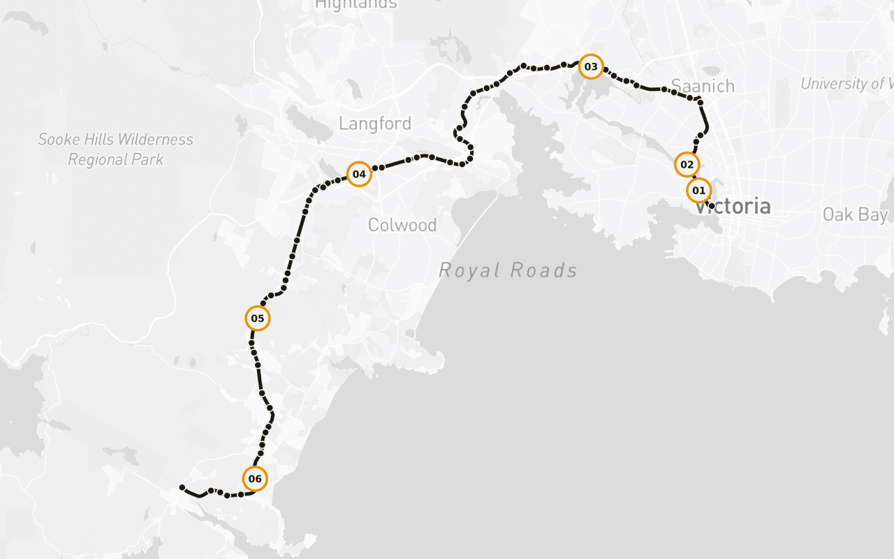
这是帮助你判断路线是否适合行程的路线地图,并非逐向导航。Camena 会沿已发布的路线播放故事。
6 / 65 个地点
带着地方感的故事。
Galloping Goose本身
为什么沿途的公里标一直在悄悄骗你,加洛平古斯的里程,是从一座你根本骑不到的桥量起的。
Selkirk Trestle 木栈桥
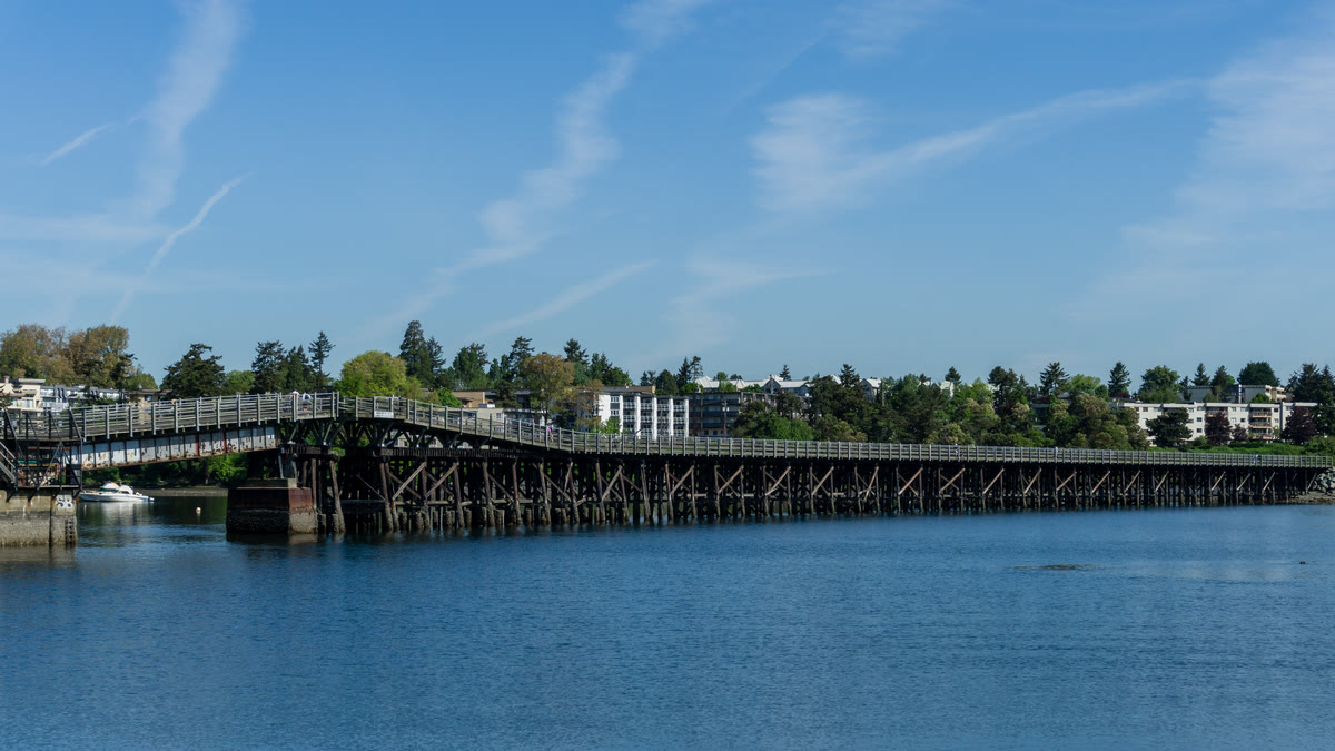
三百米长的木栈桥横跨潮汐水面,宽五米,刚好容得下周日午后的散步者、狗、骑行者和钓鲱鱼的人。
Esquimalt Nation 的领地
这条绿廊穿行在未割让的领地之上,这一段属于说 Lekwungen 语的族群,也就是今天的 Esquimalt 与 Songhees 两个原住民族(Esquimalt Nation、Songhees Nation)导览会把这件事讲得明明白白。
Garry Oak 之乡
Garry oak 的地盘:不列颠哥伦比亚省唯一的原生橡树,也是整个加拿大西部仅有的两种之一,长在一条狭窄的地带里,而这条绿廊恰好从中穿过。
分段骑行
人们究竟是怎么骑这条绿廊的,地图对谁都太客气,而 CRD 自己的步道指南,对谁能一天骑完说得直白得多。
Matheson Lake:公园历史
早在铁路出现之前,这条路线就已存在:一条穿过这片土地的步道,是海岸与省府之间最实际的往来方式,而在最远的那一端,还有一段公园的历史等着你。
适合人群 · 终点 · 离线
先讲实用,再说风景。
适合谁
前13公里为铺装路面(Johnson Street Bridge 至 Wale Road);过了 Atkins Avenue 便是压实的旧铁路路基,偏乡野、路面较糙,有起伏,偶尔还有泥坑。建议骑山地车或砾石公路车;Atkins 以西不建议骑普通城市自行车。
在哪里结束
单程终点在马西森湖步道口;可原路骑回,也可以随时按当天状态掉头。
离线
出发前下载导览。即使经过无信号区域或旅行时不使用漫游,音频、路线和地点详情仍可使用。实时街道地图图像不属于此离线承诺的一部分。
Victoria · 骑行 · 12.99 美元 · 一次性购买
带上这条路线出发。
下载 Camena,在导览起点打开,故事会在路上找到你。
还有 3 条路线
其他路线